Combined GIS and BIM approach to Road Resurfacing
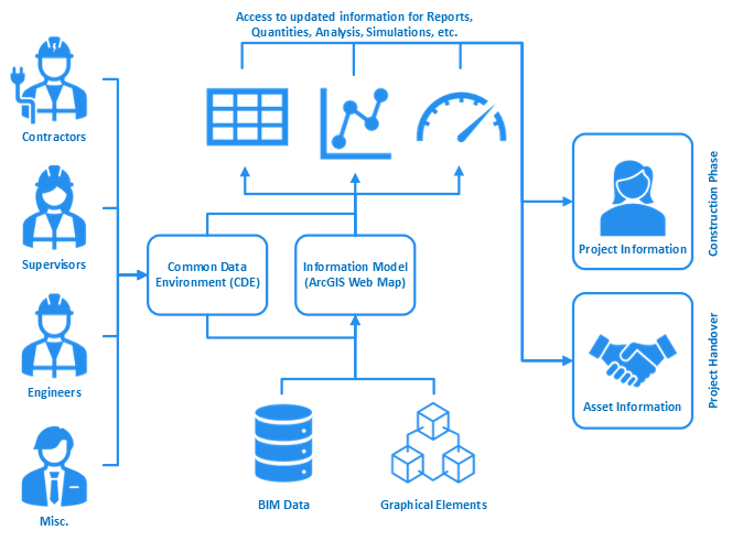
My experience using a combined GIS and BIM approach for a Road Resurfacing project
My experience using a combined GIS and BIM approach for a Road Resurfacing project
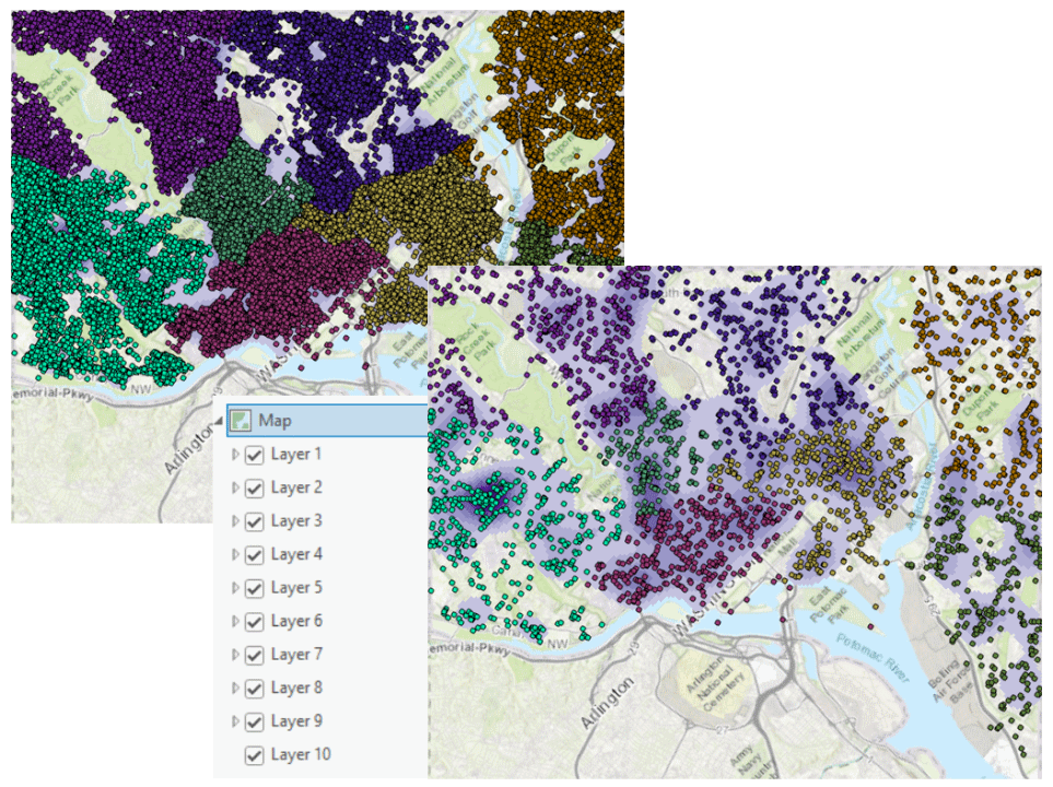
Tutorial on how to modify properties of multiple layers in a map with Python
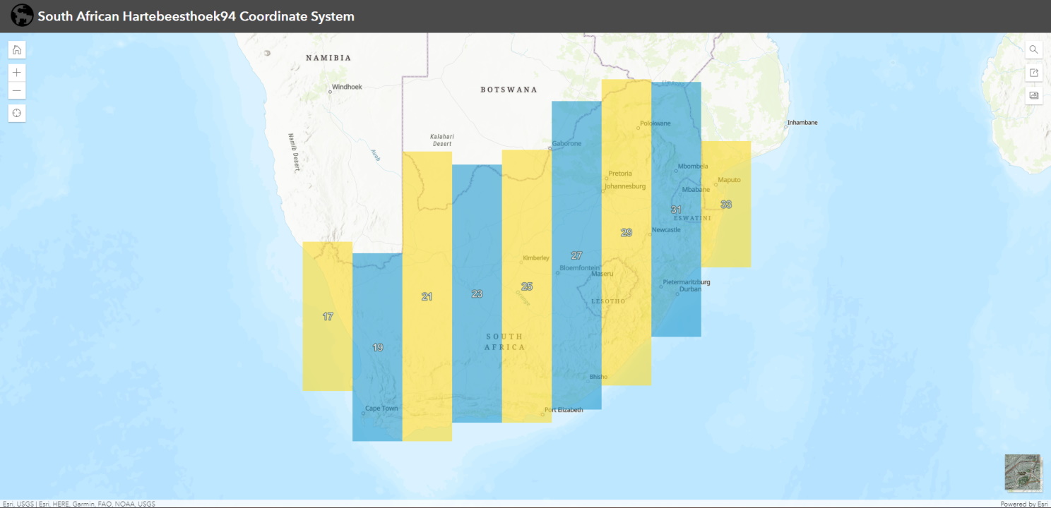
A web map application to help visualise the South African Hartebeesthoek94 Coordinate System
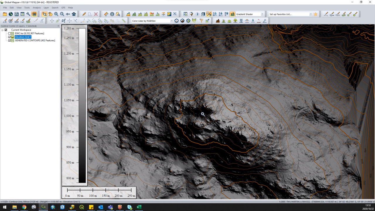
A quick demonstration of a workflow for contour generation using point cloud data in Global Mapper.